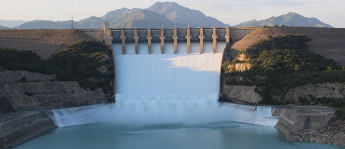
The Indus River basin stretches across a vast area in Pakistan, from the Himalaya Mountains to the Arabian Sea coast. The Tarbela Dam plays a significant role within this basin as part of the Indus Basin Project, established through a water treaty between India and Pakistan in 1960. This treaty secured Pakistan’s access to water resources independently from India’s control over upstream rivers. Completed in 1977, the Tarbela Dam was primarily built for water storage rather than power generation.
The dam holds back the turquoise waters of the Indus River, which reflects the abundance of silt and clay particles carried by the water released through the dam’s spillways. As the world’s largest earth and rock fill dam, it has a massive volume and stands tall at a height of 147 meters above the riverbed. While the dam has successfully stored water for agricultural use, its construction has had negative impacts on the Indus river delta.
The delta region has experienced reduced flooding and decreased water flow due to the dam, resulting in the loss of mangrove stands and a decline in certain fish species. This illustrates the complex relationship between large-scale infrastructure projects and their environmental consequences. Nevertheless, the Tarbela Dam remains an essential component of Pakistan’s water management system, allowing the country to utilize its water resources effectively for agriculture and other purposes.


