

NASA, the American space agency, has shared pictures of flooded areas in the UAE caused by heavy rain on Tuesday.
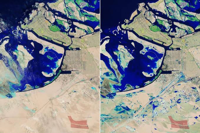
NASA described the storm as slow-moving and said it affected the Gulf states severely, with some places getting more rain in a day than they usually do in a whole year.
The images, taken by Landsat 9 on April 19, show ongoing flooding, especially in Jebel Ali, an industrial area south of the port, and near green resorts and parks south of Palm Jebel Ali. The pictures use colors to show water, which appears blue, and help to see how widespread the flooding is.
Landsat 9 is a satellite from NASA that helps keep an eye on land resources that humans need to live.
Dawoud Al Hajri, the head of the civic body, said that Dubai got more than 220mm of rain in just one day, which is more than it usually gets in a whole year.