


The Himalayan and Karakoram Mountain ranges, covered with snow, provide water for Pakistan’s river system. The name “Punjab” is derived from the five rivers that make up the system and mostly run through the province of Punjab; “panj” means “five” and “aab” means “water.” The five rivers of Pakistan are the Indus, Chenab, Ravi, Sultej, and Jhelum.
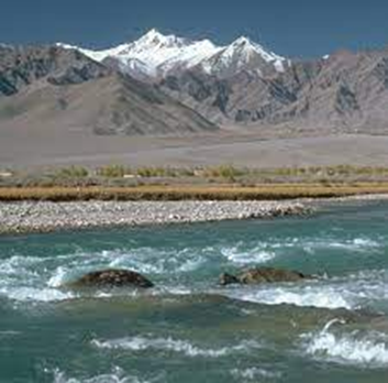
Jhelum River
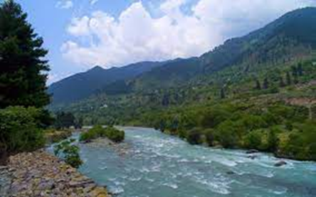
The Jhelum River traverses eastern Pakistan and northwest India. Punjab’s five rivers flow through the Srinagar district, a tributary of the Indus River and measure around 725 kilometres (450 miles).
As the raging river rushes past, you may experience some of the most breathtaking natural beauty and perspectives when strolling along the Jhelum River’s banks.
Like the River Chenab, the River Jhelum is a source of inspiration for writers, poets, and brave soldiers of the soil. As it passes through some of Punjab’s most significant cities, the river has sparked a desire for the country in the hearts of the warriors.
River Chenab
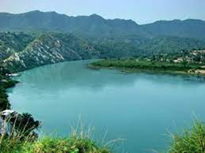
One of the main and most important rivers all of the five rivers is the river Chenab, which flows through both countries India and Pakistan; it is created by the meeting of Chandra and Bhaga, two upper Himalayan headwaters, in the Himachal Pradesh area of Lahaul and Spiti. The Chenab River finally joins the Indus River after passing by the Jammu region, which is present in Jammu and Kashmir, India, and the Punjab plains, Pakistan.
In terms of the Indus Water Treaty, Pakistan received access to the water from the Chenab River. In India, non-consumptive applications like producing power are allowed. The Chenab River is frequently used for irrigation in Pakistan.
Geography
The Chandra and Bhaga rivers meet at Tandi, 8 kilometres (5.0 miles) southwest of Keylong, in the Indian state of Himachal Pradesh, to form the river.
River Ravi
The Ravi River is a transnational river that flows between or through both countries, India and Pakistan. River Ravi is one of all five rivers that traverse Punjab.
According to the 1960 Indus Waters Treaty, India received the Ravi and two additional rivers. After that, Pakistan built the Indus Basin Project, which uses water transfer from the Indus system’s western rivers to rehydrate the Ravi. For irrigation, hydropower, and multipurpose use, many projects were created by India for the following use.
Geography
The headwaters of the Indus River Basin are found in the Ravi River, a transboundary river that runs through Pakistan and India. The water which flows from the river Ravi then enters the Arabian Sea following the Indus River in Pakistan.
Near the town of Bara Bhangal, in Himachal Pradesh’s Kangra district, is where the river originates. After flowing for 720 kilometres (450 mi), the total catchment area is 14,442 square kilometres, where the river drains India. As it moves westward, it creates a triangular zone enclosed by the Pir Panjal and Dhauladhar ranges.
River Sutluj
Pakistan’s longest river, the Sutlej, flows through the state of Punjab. It is a transnational river that travels across Pakistan and northern India. The Sutlej River is known as Satadree in the local tongue. Sutlej river starts from the west of the catchment area of Lake Rakashastal in Tibet.
Under the Indus Water treaty, Sutlej’s water belongs to India, which was held between India and Pakistan. Around 14 million acre-feet (MAF) of water flow through the river each year, passing upstream of the Ropar barrage, which is situated after the Bhakra dam that spans the Sutlej River.
Pakistan depends on the Sutlej River because of the role it plays in producing hydroelectric electricity. Along the Sutlej River, Pakistan has a large number of hydroelectric plants.
The 1,500-megawatt Nathpa Jhakri Dam, 1,000-megawatt Karcham Wangtoo Hydroelectric Plant, and 1,325-megawatt Bhakra Dam are a few projects.
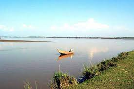
River Indus
The other name of the river Indus is the Sindhu River. Ancient Persians called the Indus River Hindu, and ancient Indians called it Sindhu; both peoples referred to it as “the boundary river.” It is Asia’s largest river.
The river traverses Pakistan, Ladakh, and western Tibet in China. Before joining the Arabian Sea, the river travels through India’s Ladakh region and into Gilgit-Baltistan.
Geography
The river drains more than 1,165,000 km2 of land. The annual flow is around 243 km. The geography of the river is quite interesting. It begins in the Himalayan Mountains, Karakoram Mountains, and Hindu Kush Mountains, where there are springs and glaciers.
The northern portion of the Indus Valley and its tributaries make up the Punjab region, whereas Sindh is composed of the river’s lower course and empties into a large delta. Learn more about Karachi’s top tourist destinations.
Most of the country’s agricultural output is produced in the province of Punjab, where the Indus River is a vital supply for Pakistan’s economy.
Dams and barrages linked with the river Jhelum
In India, the river offers a lot of potential for electricity generation. The following water control structures were conducted as part of the Indus Basin project:
- The plant is situated in Jammu and Kashmir. Mangla dam is one of the biggest earth-filled dams in the world, which was erected in 1967; its storage capacity is 7.3 km3.
- Built-in 1967,
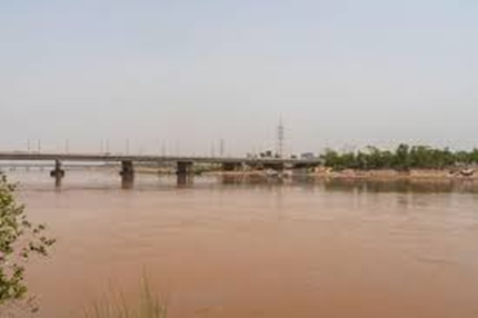
- Trimmer Barrage, built-in 1939 near the Chenab’s confluence 20 kilometres from Jhang Sadar, has a discharge capacity of 18,000 m3/s.
- In 1933, Haranpur (Victoria Bridge) was built. Near Chak Nizam Village, around 5 kilometers from Malakwal. It is mostly used by the Pakistan railway; its length is almost 1 kilometre. It also has a side route for light traffic like cars, cycles, motorbikes, and walkers.
- In Jammu and Kashmir, the Uri dam is located, which has a 480 MW hydroelectric power plant.
- The 330 MW Kishanganga Hydroelectric
Canals linked with the Jhelum River
- The upper Jhelum canal flows.
- The chashma Jhelum link canal links the chashma barrage.
- The Rasul Qadirabad link canal.
Conclusion
So, these are Pakistan’s important rivers. These are not only economically significant for Pakistan, but they also benefit other industries such as tourism, electricity generation, and agriculture.