

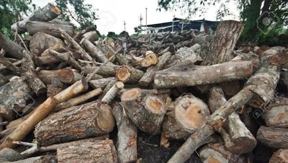
New satellite imagery comparing the years 2019 and 2026 has highlighted alarming levels of deforestation in parts of Upper Dir, Khyber Pakhtunkhwa, particularly in the Jatkool village area of Sheringal. The images reveal a dramatic decline in forest cover over the past seven years, showing that large stretches of land that were once densely covered with trees have now turned barren and exposed.
Reports indicate that nearly 66.58 hectares of forest land have been cleared during this period, sparking growing concern among environmental experts and local communities. The visible transformation in the landscape has renewed debate over illegal logging, weak forest monitoring, and the urgent need for stronger conservation measures in mountainous regions of the province.
Environmental specialists warn that continued tree loss in Upper Dir could have serious long-term consequences for both nature and nearby populations. Forests in these regions play a critical role in preventing soil erosion, stabilizing mountain slopes, regulating water systems, and protecting wildlife habitats. The removal of large numbers of trees increases the risk of landslides, flash floods, and biodiversity decline, especially during heavy rainfall seasons.
The situation has once again drawn attention to the importance of sustainable forest management and stricter enforcement against illegal timber activities. Conservation advocates say immediate restoration efforts and stronger protection policies are necessary to preserve the remaining forest cover and reduce environmental damage in vulnerable areas of Upper Dir.