

Pakistan is a country that is blessed with immense beauty. It is known all over the world for its geographical diversity, whether it’s lovely lakes, scenic views of mountain ranges, breathtaking desserts, scenic valleys, or hill stations. They draw an increasing number of tourists to the country, and they are the primary reason for the country’s tourism to grow.
Here in this article, we will specifically talk about the best and major mountain ranges in Pakistan, so if you are someone who is interested in knowing this or someone who loves hiking and tracking and want to gain knowledge and information regarding mountains and best peak of Pakistan, then you are at the right place. Follow this article till end to get to know about the list of mountain ranges in Pakistan.
Pakistan is home to some of the world’s most beautiful, densely packed mountain ranges, it has three of the world’s largest mountain ranges and four of the world’s highest peaks (above 8,600 meters), making it one of the most geologically expanded countries on the planet.
Furthermore, there are over 100 mountain ranges in Pakistan that are height 8 thousand meters. Also, except for the polar areas, Pakistan has the most glaciers in the world, with over 7,000. Pakistan has five of the world’s highest standalone peaks, most which are found in the Karakorum range. Mountain ranges in Pakistan map are mostly occur in the northern area of the country.
Now the question arises that how many mountain ranges in Pakistan? So there are thousands of majestic mountain ranges present here. Many more peaks in Pakistan, both named and nameless, are not yet included within the list of known mountains of Pakistan. Because of their low topographic prominence, several of the peaks on the list are generally classified as sub-peaks of other mountains rather than separate summits.
The Karakoram Range:
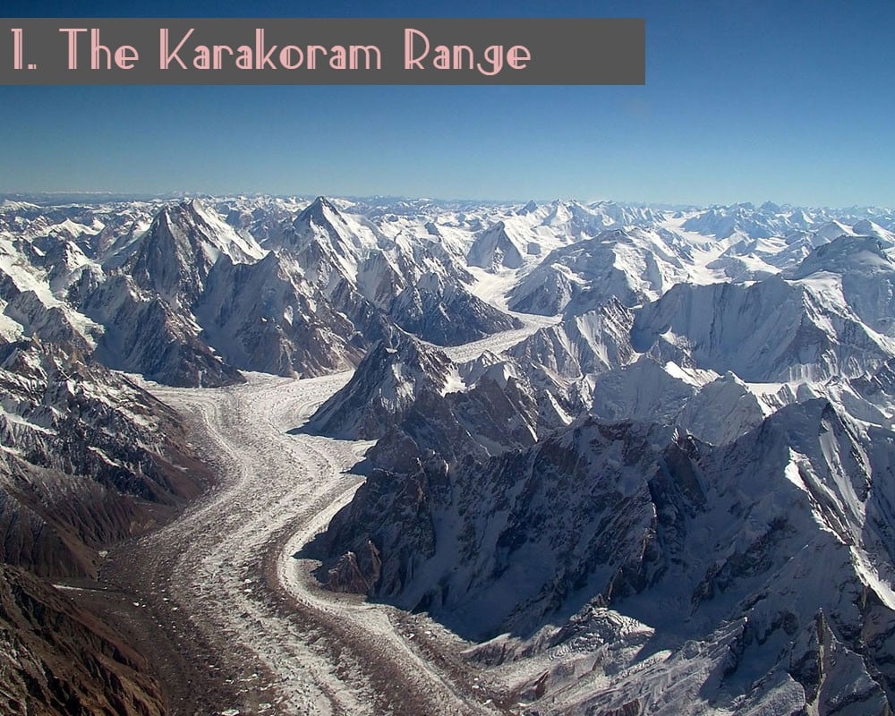
The Karakoram Range is considered being the world’s 2nd largest mountains range with 500 meters length, that contains the world 2nd top highest peak “K2” with (8,611 m) in it. And because of its difficult climb up, K2 is also referred as “Savage Mountain.” The range is found in Pakistan’s northwestern corner.
The Karakoram Range is surrounded by three countries: India’s Ladakh, China’s Xinjiang, and Pakistan’s Gilgit-Baltistan. This is one of the major mountain ranges in Pakistan and more than 50 peaks of this range has a height of 7000 meters.
The Karakoram Mountains are bordered on the northeast by the Mountain Range, and on the northern side by the Pamir Mountain Range. This range also includes the Siachen Glacier-world’s third longest glacier, as well as other peaks are K1, K3, K4, & K5.
In 1856, a European team climbed the Karakorum first time in the history, and it is now considered as the most favorite mountains range by climbers, mountaineers, and hikers. As well as, due to its beautiful surrounding the picturesque views and spectacular lakes, it is the most popular among climbers and hikers.
The Himalaya Range:
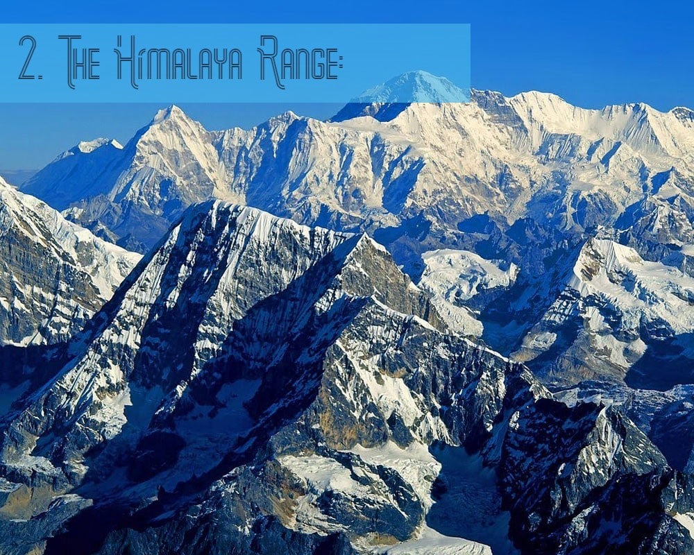
The 2nd one on our list of mountain ranges in Pakistan is the great Himalaya Range. The Himalayan Mountain Range is over 2400 kilometers long, thus becoming the world’s longest mountain range.
The Himalaya Mountain range is also known as “western mountain range” because it is residing in five different countries including Pakistan, India, China, Nepal and Bhutan and the western section of the range is in Pakistan’s Gilgit-Baltistan, in the Astore District.
It is one major mountain ranges in Pakistan, and the most famous and gigantic peak of this range is “nanga parbat” also known as the ‘Killer Mountain,’ which stands at 8,126 meters above sea level and is the world’s ninth tallest peak.
The Himalayas are a big draw for climbers in Gilgit-Baltistan, which is one of Pakistan’s most famous tourist destinations. The famed Deosai National Park is located closer to it. It is a hilly meadow of remarkable elegance & ecological value, encircled by undulating hills. Overnight camping, hunting, & hiking is all best done in the summer here.
Furthermore, Mount Everest-the world’s highest peak, is located in the Himalayas between Nepal and China.
The Salt Range:
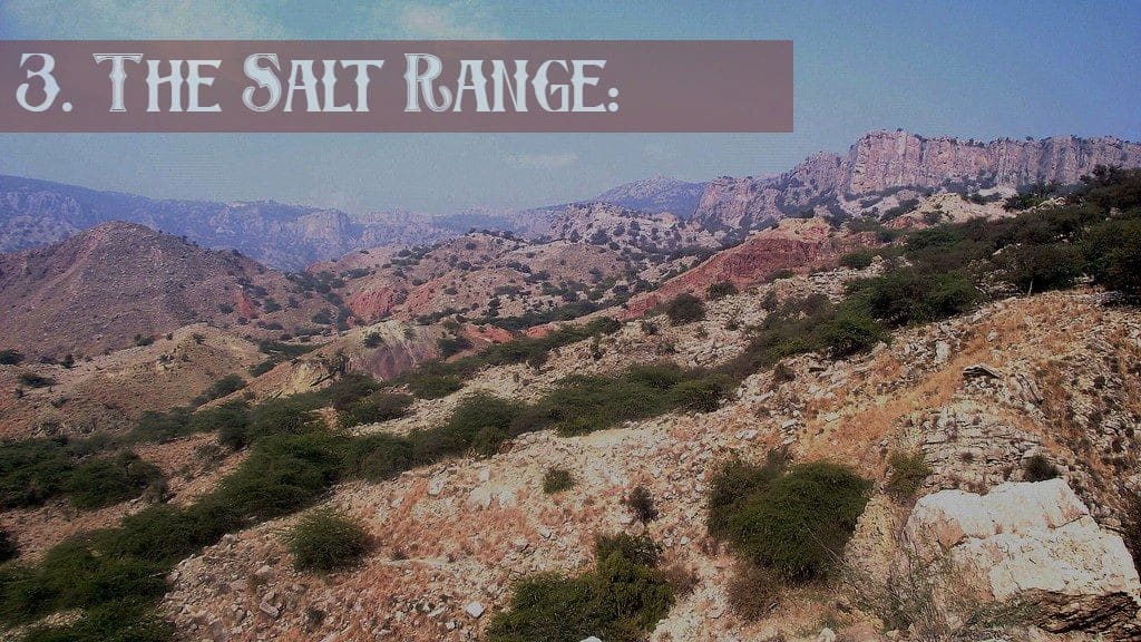
Known as the world’s richest salt range, the Salt Range originally comes from enormous amounts of rock salt that dot the landscape. The Salt Range is a mountain range in Punjab that is well known and significant for its natural beauty.
Within Punjab’s Northern Province, the salt range is a chain of mountains and low hills that extends from the southern edge of the Potohar plain to the northern edge of the Jhelum River. There are several well-known salt mines in the salt range, including those in Khewra, Mayo, Warcha, and Kalabagh, out of which the “khwera” salt mine is considered to be the world’s largest salt mine.
Several lakes, notably Uchhali & Namal Lakes, can be found within the Salt Range, rendering this area a favorite picnic destination for people. Activities available in the area include boating, hiking, and moderately challenging climbing.
In addition to a number of wildlife reserves as well as rainforests, the Salt Range is quite rich in biodiversity. It’s also home to Noorpur Reserved Forest, Chinji National Park and Simli Reserved Forest, all of which are conservation areas.
The Hindu Raj Mountains Range:
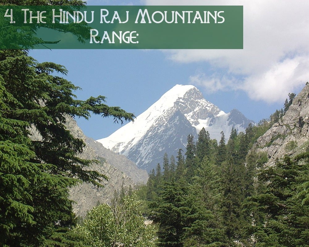
Located on the country’s northern side, between the two famous mountain ranges Hindu Kush and Karakoram, “The Hindu Raj Mountains Range” is yet another famous and major mountain range in Pakistan.
Its name “Hindu Raj” means “Hindu’s Rule”, and Hindu Raj stretches for approximately 500 miles/800 kilometers in length and 150 miles/240 kilometers in width.
A little over 6872 meters high, Koyo Zom is the tallest peak in the Hindu Raj Range while Gul Lasht Zom, Ghamubar Zom, and Buni Zom are some of the other significant peaks in the Hindu Raj Range.
A key reason for the Hindu Raj Mountain Range’s lack of popularity among tourists is the absence of prominent peaks that rise above 7000 meters in elevation, but still, it is a beautiful range having breathtaking landscapes.
The Hindu Kush Range:
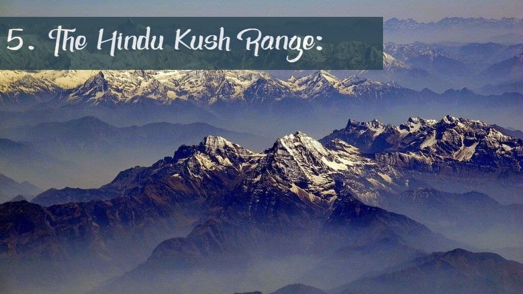
Founded in 1830, The Hindu Kush mountains Range is another beautiful yet mountain range in Pakistan. The Hindu Kush Mountain Range, which stretches over 950 meters in length and shares its boundaries with Afghanistan and Pakistan, is located in the western part of the Karakorum and Himalaya ranges.
Among the series Hindu Kush Mountains, Tirich Mir is the highest peak in the range. It is 7,690 meters high and can be found in the region of Chitral Valley Since 1927, climbers have been attempting to reach the summit. Climbers from Norway & Pakistan made the first successful attempt on the mountain in 1950, with only a few Pakistani climbers on the team.
Starting at the Wakhjir pass, which separates Hunza and Wakhan, the first point of this mountain range begins, while beyond the Dorah Pass, in Afghanistan, is a second area of interest. Third region is located in Pakistan and runs from Swat to the Kohistan regions. The Indus River separates it from the Karakoram Mountains on the eastern edge of the Himalayas.
The Sulaiman mountain range:
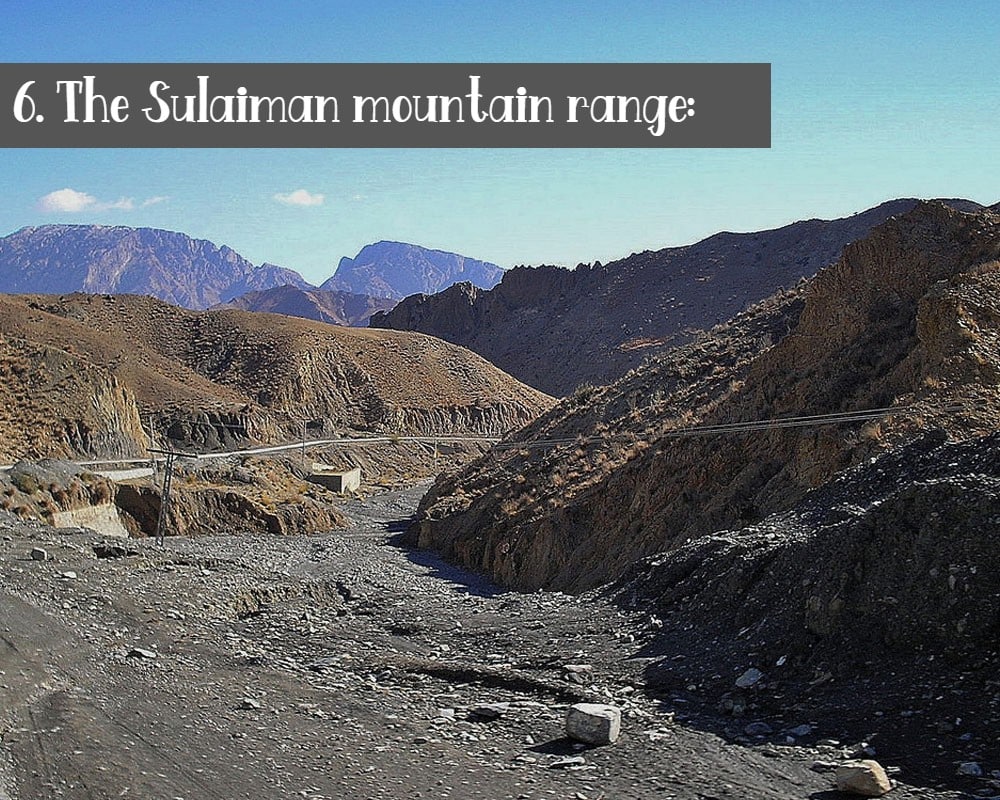
Located in the northern region of Balochistan, the Sulaiman mountain range connects a portion of its territory with Afghanistan. In addition to being located in northern Baluchistan, the Suleiman Mountain Range also connects a portion of its territory with Afghanistan. Furthermore, it ties with the boundary between the Subcontinent & the Iranian Plains.
Takht-e-Suleiman is the tallest peak in this Range, rising to 3,487 m water depth. The second largest point is Khilafat Hill, which rises to 3,475 meters and is located in Ziarat District.
It is the country’s fourth most significant and major mountain range. In contrast to the Northern Peaks, these mountains are less jagged and have a medium height, making it a very distinct mountain in terms of character.
As regard to its name, Pashtun tales said that prophet Suleiman climbed over this range that why it is called “Sulaiman mountain range”, while in another mythology, the Takht-e-Sulaiman is where Noah’s Ark came to rest after making landfall. In another mythology, the Takht-e-Sulaiman is where Noah’s Ark came to rest after making landfall.
On top of Takht-e-Sulaiman, according to another tale, is the tomb of Qais Abdur Rashid, the fabled ancestor of the Pashtun people.
Kirthar Mountain Range:
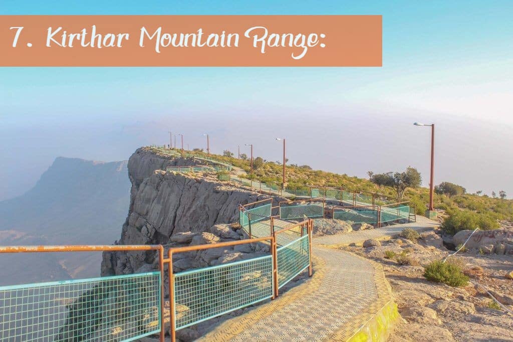
The Kirthar Range serves as a border between the 2 provinces of the country, i.e., Sindh & Balochistan. Kirthar’s large spectrum stretches for more than 300 kilometers from the Mula River.
The Kirthar Mountains have an altitude of 2,151 meters/7,057 ft at its oldest documented location, with Gorakh Hills at 5,688 meters/7,057 ft being its tallest mountain. Gorakh Hills are regarded as a “Murree of Sindh” by the inhabitants of Sindh, who live nearby.
This range encompasses an area of approximately 9,000 sq. kms. There are many other passes in the Kirthar Range, but the Gaji Lak Pass, which connects the towns of Zidi and Khuzdar with the town of Jhalawan, is the only one that is frequently utilised.
It is also reported that Taung Tombs from the 16th to 18th centuries can be located in this mountain area.